Another Voyage
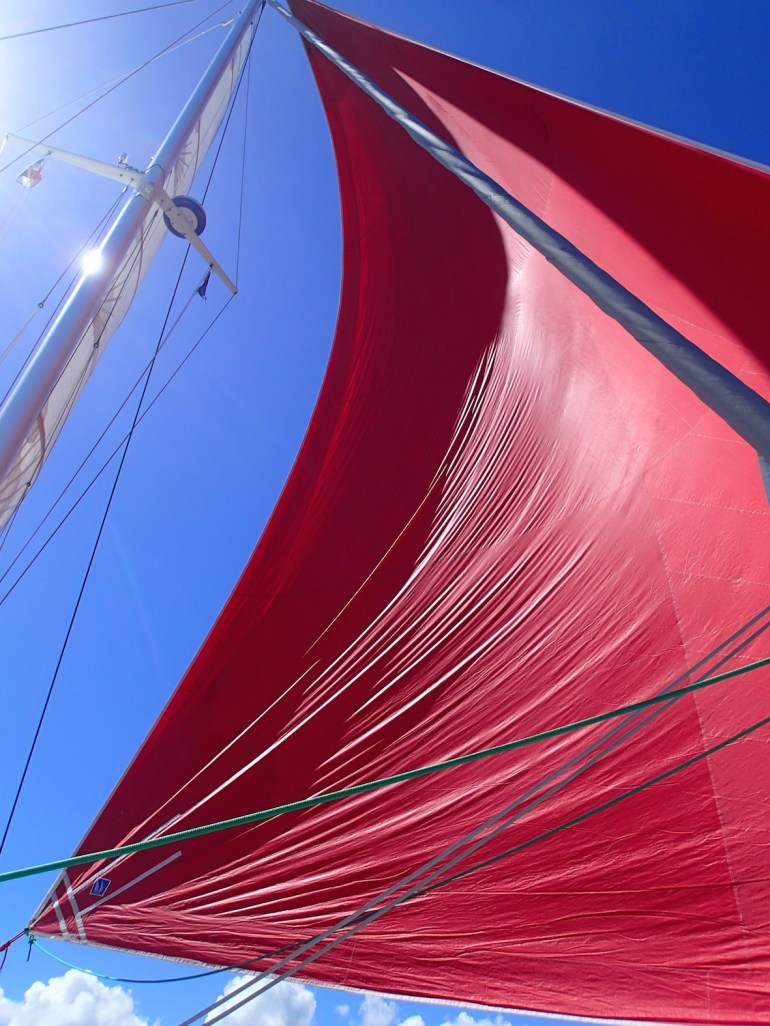
So we sailed away from the Dominican Republic, past the Caicos Bank to arrive on the southern shore of Mayaguana, the easternmost outpost of the Bahamas. The trip was about 200 miles and Escapade just ate them up. The winds were light, so we hoisted the full mainsail and unfurled the big red gennaker, the most canvas we can carry, total 180 sqm of sail. That rig pulls Escapade along nicely and we were averaging 10 kts until nightfall when we reduced sail and slowed the boat for the hours of darkness. This has become our habit now and we sometimes question it, particularly when the night is as benign as this. The Caicos were protecting us from the Atlantic swell so we were sailing over almost flat water with 15kts of breeze on the beam and a huge full moon to show the way. We could easily have left the big gennaker up, but we are short-handed and you never know when one of those 30kt squalls might pass by. So we trundled on through the night at about 8kts with main and jib, and both slept well off-watch.
At dawn we were both on deck and the gennaker was unfurled again for the final approach to the island of Mayaguana. A nice fish was just being reeled in, splashing towards the boat when a large black fin appeared, the line went slack and our lunch had been stolen.
We had covered the 200 miles in about 23 hours of really enjoyable sailing with the wind gradually veering so we could ease sheets onto a broad reach. Finally we dropped sails and motored carefully between coral heads at the entrance to the glorious aquamarine lagoon of Abrahams Bay.
Another Country
The Bahamas consists of 700 inhabited islands and thousands of uninhabited islets and cays. There is more coral in the Bahamas than Australia’s Great Barrier Reef. I have always wanted to sail through these islands. I’ve heard about the tricky weather and very shallow water, but we have the right boat for that now. We have arrived at the easternmost tip of the chain which stretches 450 miles west and north towards Florida. Up that way is Nassau, cruise ships and casinos. Down here we are in the ‘Out Islands’, and this place is the end of the line, the ‘first and last’ port of entry to clear in or out of the island nation.
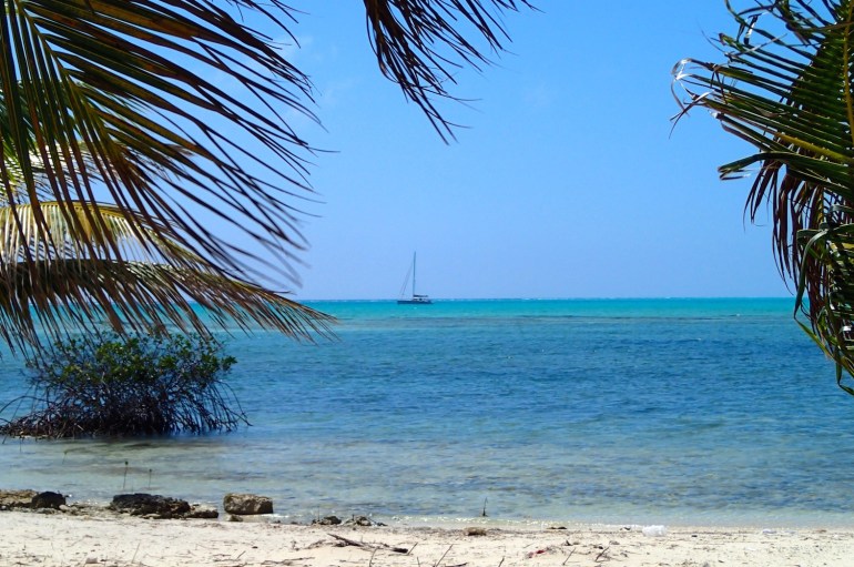
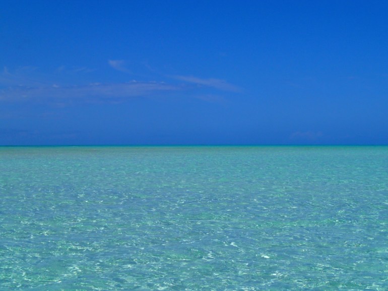
We anchor in 2 metres of transparent water over white sand. The lagoon is 5 miles long, only one other boat in sight. Looks like our kind of place. We dinghy ashore to clear customs and explore the settlement, didn’t take long. There is a bar/restaurant (closed, owner away), a grocery store (empty shelves, no supply boat for 10 days), a school, church, a few chickens running around, and that’s about it. Total population of Mayaguana approx 200. The customs officer described the general pace in the island as ‘slow’. I’ll say. Anyway, we’re not here for the nightlife.
The lagoon is beautiful, after a quick recce on a windsurfer, we dinghy out towards the reef and go lobster hunting with snorkels and spear. Dawn spots the twitching antennae and locates a gang/herd/posse (collective noun for lobsters anyone?) of fine specimens shuffling around in a coral cave. We spear a couple and swim back to the dinghy pursued by a large barracuda who is clearly attracted by the vibrating and squeaking of a big spiny lobster struggling to attack me despite the fact that he has a spear through his head. A spectacular seafood supper on board with our friends from Think Good Thoughts who have arrived and anchored nearby.

Weather
In all of our travels ‘Down Island’ over these last two winters, the weather forecast every day, had we bothered to get one, would have been something very like this:
Temperature 25-28 C, Wind E 15-18 kts, gusting to 25kts in squalls. Mainly sunny, partly cloudy, occasional showers.
That’s usually it for the Lesser Antilles, maybe a bit N of E, sometimes a bit S of E, but basically Easterly trade winds every day. So you start to look at anchorages in a sort of two dimensional way, knowing that you will always be swinging to the rising sun and watching the it go down aft of the cockpit. (So convenient for sun-downers.) Sometimes the trades will pipe up and blow 20 kts for a few days, sometimes backing off to 10-12 for a bit, but the above forecast would cover most of our time in those islands. So we would often cruise up to a beach and drop a hook in very shallow water, backing off on enough chain but without much concern for a big change in wind direction. I remember the wind did once try to blow out of the west for a couple of hours when we were anchored off Barbuda, it felt like a major disruption to the laws of nature and we could have ended up on the beach had we not been spooked earlier by the weird weather and moved to a new spot.
Here in the Bahamas we realise how spoilt we have become by all those predictable E trades. Now we are far enough north to feel the effects of winter storms rolling down the east coast of USA, as well as more general, swirling, chaotic, old fashioned, weather. We’re not used to this! It takes a bit of planning and research. We need to download GRIB weather files from our satellite phone and check pilot books. Will today’s comfortable anchorage still work in tomorrow’s wind? As I write this the wind has swung from S to N this morning, I may go and have a look at the anchor again.
We are still in the tropics, just, but this does feel like a new dimension.
(I realise how ridiculous all this will sound to my sailing friends elsewhere, in Guernsey, for example.)
We spent a few days in Mayaguana as a front passed and the wind clocked around our anchor. Fronts bring a nice windsurfing breeze!

The front passed and we had a great forecast for the 60 mile hop to the next stop: Acklins Island. Dawn had researched an anchorage called Lovely Bay which didn’t even get a mention in our Bahamas guide book. The entrance is through a reef pass and the bay is very shallow, not much water for a monohull but we only need a metre with the daggerboards up. Soon we are swinging in a gigantic shallow turquoise swimming pool, tucked in behind reef fringed islets. The bay is vast, miles across and no other boats in sight.
Ashore we meet Dick who has spent the last 16 winters there and tells us we are the first visitors to the bay this season! Acklins was hit by Hurricane Joachin in October. The storm was tracking way North off Carolina, then it turned south and headed straight for these Islands, where it stayed and blew for three days. A freak storm. The damage was devastating. the water in the huge ‘Bight of Acklins’ had been blown over the island which was then deep underwater. Roads destroyed, buildings blown away, fishing boats ‘just gone’. Remarkably nobody was killed. Lovely Bay is now just slightly less lovely having been stripped of many of the hundreds of coconut palms along the shore. One morning I was running along a dirt track hurdling the wrecked power lines and uprooted palms, this whole area had been a metre under water at the height of the storm. But all around are scrub bushes, mangroves, fragrant wild herbs, sea grape trees, yuccas and young palms all thriving. And the lizard population seems to have shrugged off the storm. Destruction and renewal. Dick directed us to an abandoned watermelon patch and told us how to spot a ripe one. Down the track, there they were, planted before the hurricane, lying on sunbaked sandy ground where you would expect nothing to grow, somehow inflating themselves with fresh water and sugar. We scrumped as many as we could carry. The sun shone down on Lovely Bay, we windsurfed, snorkelled the reefs, caught more lobster and watched the stingrays gliding under the boat. But then the weather threatened a change and it was time to make a new plan.

Crooked Island
We hardly ever use our engines except on arrival and departure from an anchorage. Escapade can reach at 6kts in 6kts of wind, so the motors don’t get much use. Actually we have only topped up the diesel tanks twice since we left France in 2014. There is always breeze in the Caribbean, but not always up here! In about 3kts we motorsailed along the reef to the lighthouse at the NW tip of Crooked Island. We took a paddle board ashore to the storm-ravaged settlement at Landrail Point. This place got hit the hardest, we saw homes filled with sand, roofs blown off and debris scattered everywhere. The community are rebuilding. Everyone in town is now a builder. We had a great supper of fried grouper at the only restaurant for miles around, if you’re passing through be sure to reserve a table with Willhamena at Gibsons Lunch Room. These ‘Out Islands’ feel so remote. It was interesting that the Americans we met that night were from the wilds of Alaska and Minnesota. They have winter homes here and they are used to living in tiny isolated communities.


Where is everybody?
You know how wherever you go, people say “oh you should have seen this place 30 years ago, there was nothing here”. Everywhere has become more developed, busier, more people, more buildings and cars. Not here. The populations of the Out Islands have been falling for years. In the 1940s Lovely Bay was home to thousands, fishing, growing crops and exporting food around the islands. Now there may be 100 people left, more abandoned their homes after the storm. Our pilot book listed the population of Mayaguana at 500 but that was published 5 years ago, now less than half, the same on Crooked Island. I don’t think we’ve ever been to a place where the normal forces of ‘progress’ seem to be in reverse. At the current rate these places will all be abandoned in a few years. But the islands are wonderful and the water surrounding them is just stunning, crystal clear shallow seas. We have sailed past more anchorages probably all as lovely as Lovely Bay, you could spend a winter exploring here and hardly see another boat.

Islands In The Stream
This title is borrowed from Hemingway’s novel set in the Gulf Stream waters of Cuba and the Bahamas, based on his experiences hunting U Boats here in WWII. I read it recently, great descriptions of life on the lagoons and an epic account of a boy’s long and brutal fight with a big fish that finally evades him. Somehow the lost fish becomes more significant than if it had been landed. Very reminiscent of Mike’s giant tuna off Morocco; a long hard struggle brought the fish almost within reach of Escapade’s gaff. Those who were on board that morning won’t forget Mike’s ‘one that got away’.
These waters are so fishy we are trolling small lures and hoping we don’t attract anything too big. And if we are lucky to hook a sensible sized fish, it’s a rush to get it on board before something bigger takes an interest!
Long Island
Our supplies were running low. Protein is easy, we have been catching fish and diving for conch and lobster, but it’s nearly two weeks since our last supermarket in Puerto Plata DR and our fruit bowl is down to half a watermelon and a few limes.
In search of a tomato, we set a course for Clarence Town Long Island, 35 miles away. We dropped the hook in yet another blue lagoon. (Blah blah, turquoise, blah, white sand, blah, coconuts, blah blah).
Ashore we find another sleepy settlement. I asked in a gas station where the nearest grocery store was. “Storm blew it away”. We saw it, the empty fridges, freezers and food counters were still standing on the concrete floor but the walls and roof were ‘just gone’. The only other person around was Marcus who was paying for his fuel and kindly offered to drive us all over the island to get our provisions and back to the dock. A twenty mile round trip and impromptu tour of Long Island for which he would accept no payment. What a guy! Typical of the warm and generous hospitality shown to us strangers in the Out Islands.

Grocery Store After Hurricane Joachin
So we scored green tomatoes which are now ripening in the sun.
We have only seen four of the Bahamas so far but they are already rating pretty high on the ‘Escapade Island Ranking’ scale. Next update soon..

OLYMPUS DIGITAL CAMERA


Love hearing about your travels. What a lovely way to live. Hoping to see you two in June. Big 50 celebrations in London😊 Lots of love from the Gold Coast xx
LikeLike
Believe it or not its a “risk” of lobsters 🙂
>
LikeLike
Well, the Bahamas appear to be a hit but also badly hit by the tornado. A great read. xx
LikeLike
I’ve learned the collective noun is a ‘risk’ of lobsters. Who knew?
LikeLike